Services – Space-Elements

Space-Elements

Services

GIS

Rainguage Station
Degital Elevation Map
Contour Profile
Slope_AOI
Geology
Geomorphology
Land Use
Surface Temprature
Reserved Forest
Time-Lapse
Toposheet

HYDROLOGY STUDY

Hydrology has evolved as a science in response to the need to understand the complex water systems of the Earth. Hydrology is the science that encompasses the occurrence, distribution, movement, and properties of the waters of the earth and their relationship with the environment within each phase of the hydrologic cycle. We study the fundamental transport processes to be able to describe the quantity and quality of water as it moves through the hydraulic cycle to solve water problems.

SURFACE WATER ASSESSMENT

The surface hydrological model will be used to simulate rainfall generation and flow routing through the upstream catchments. The surface hydrological modeling will provide critical run-off hydrographs for the area.

Rainwater calculation and water demand will be derived to calculate the surface water balance of the premises. Water balance will represent the water footprint of the premises, which accounted for directing water consumption required for operation and maintenance of the facility.

WATER AUDITING
WATER AUDITING
STORM WATER NETWORK DESIGN
WATER BALANCING
WATER BALANCING
INTENSITY DURATION FREQUENCY CURVE
HYDROGRAPH
HYDROGRAPH
WATER TESTING
WATER TESTING

GROUNDWATER STUDY

This study intends to assess the potential water-bearing capacity and water recharge probabilities of underground aquifer systems. The study helps us to understand the hydrogeological conditions through a geophysical survey of the land.  Study results are being analyzed to calculate the groundwater balance of an aquifer of the study area.
RESISTIVITY SURVEY
RESISTIVITY SURVEY
AQUIFER RECHARGE -INDUSTRIAL APPLICATION
AQUIFER RECHARGE-COMMERCIAL APPLICATION
AQUIFER RECHARGE-RESIDENTIAL APPLICATION
RECHARGE IN MULTIPLE AQUIFER
AQUIFER RECHARGE-COMMERCIAL APPLICATION

FLOOD ANALYSIS

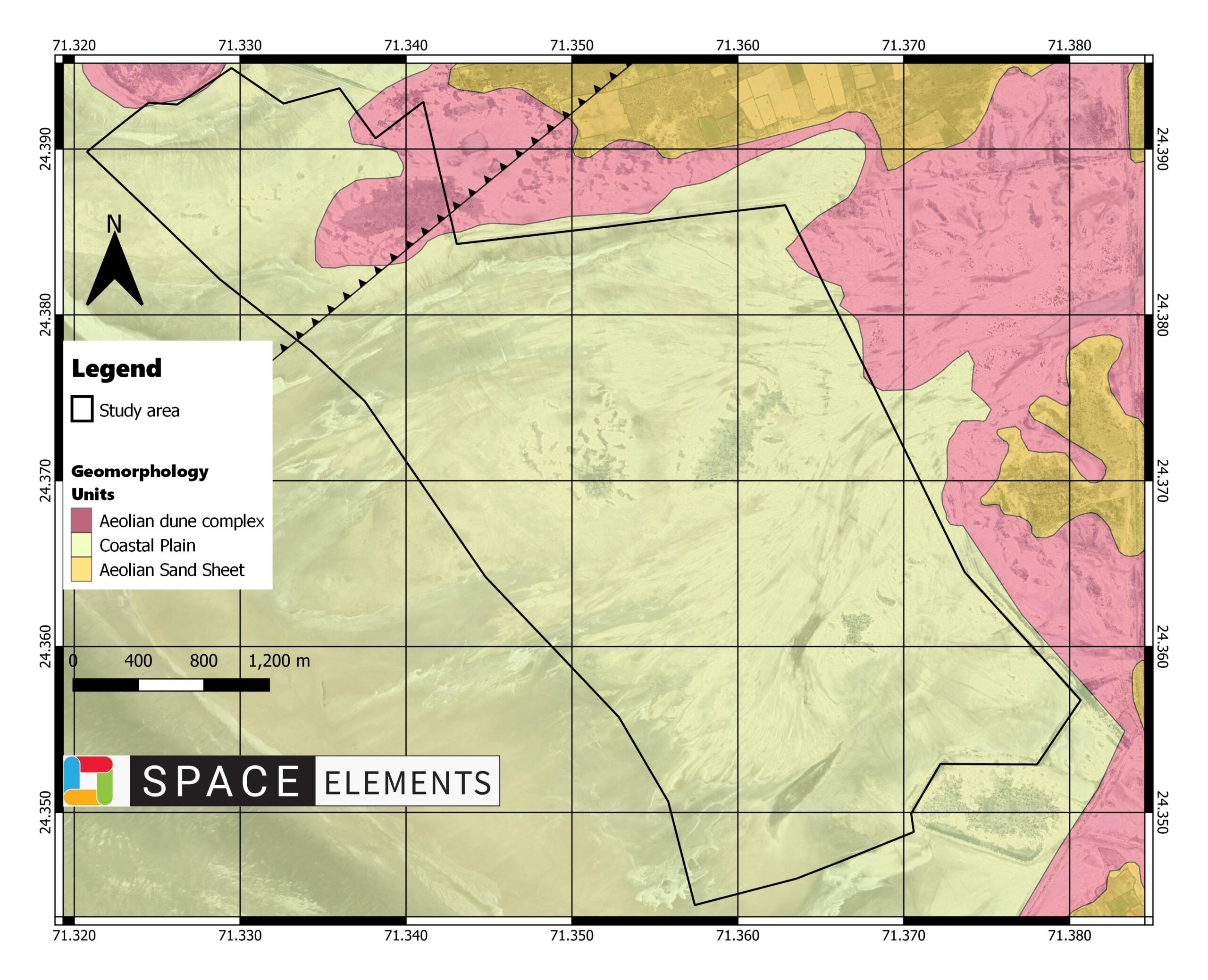
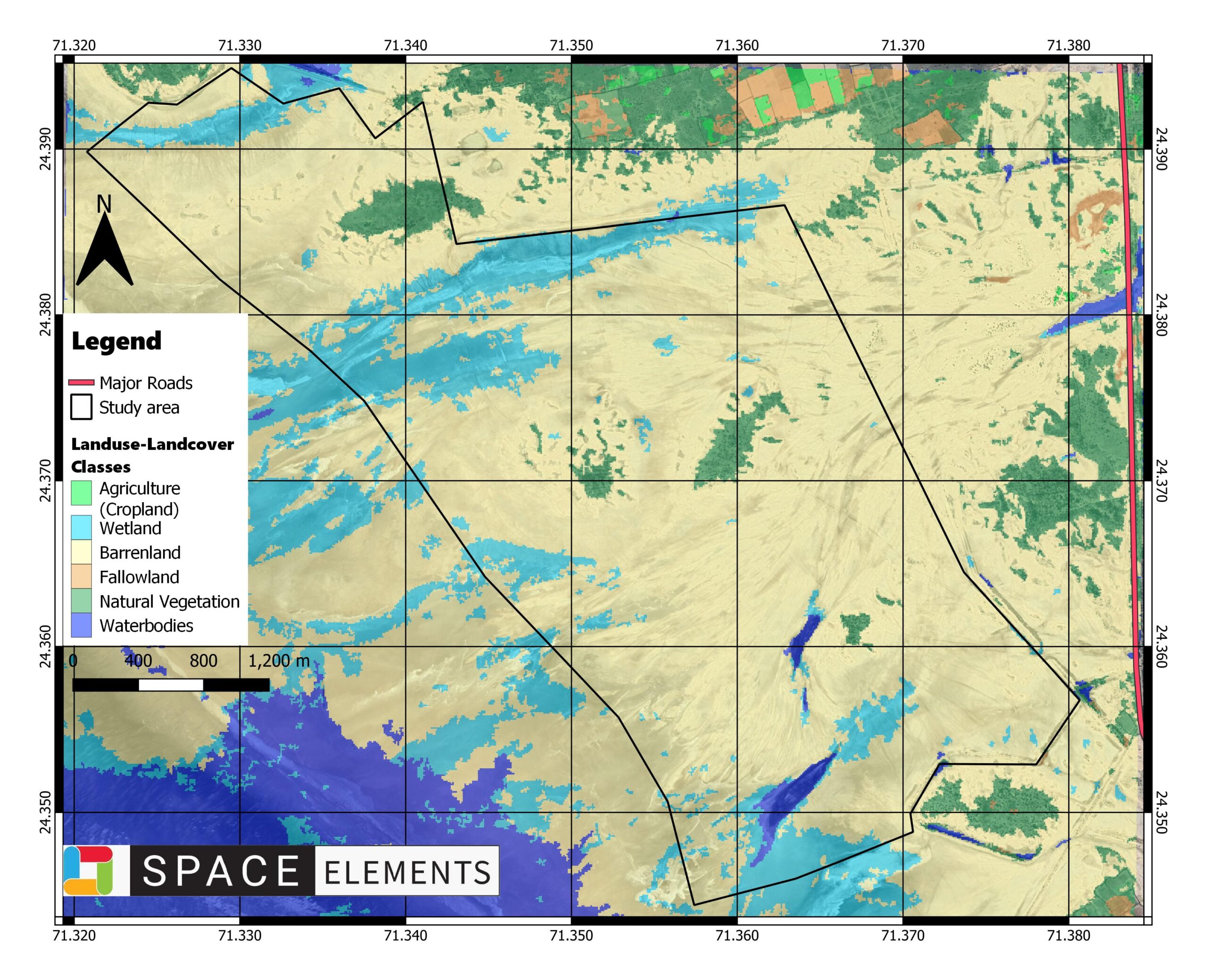
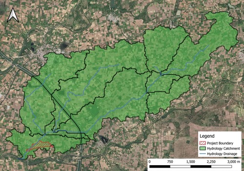
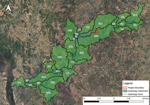
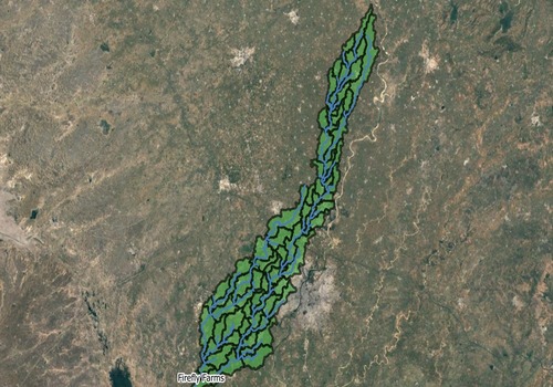
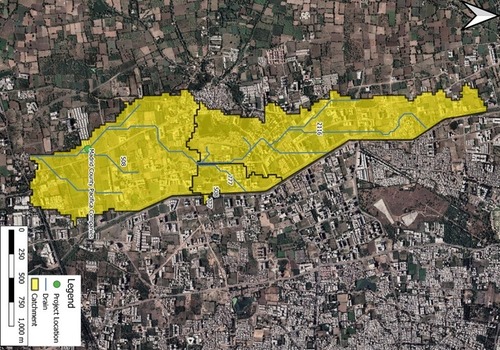
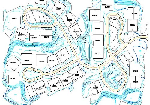
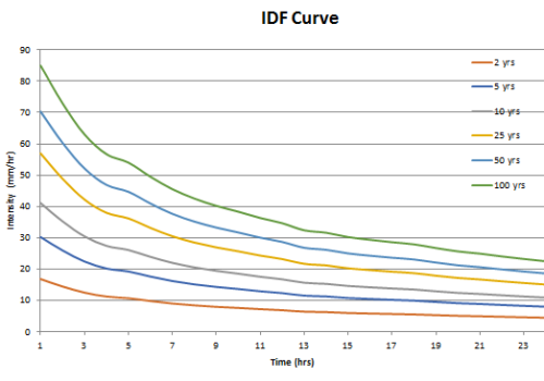
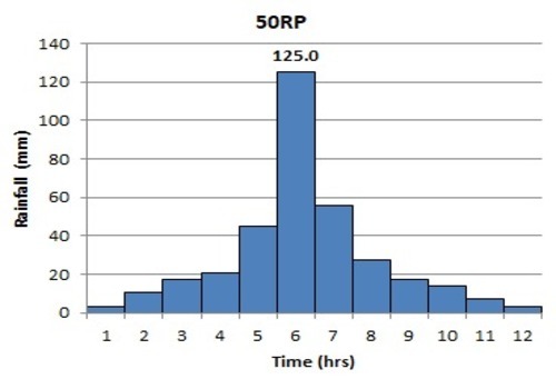
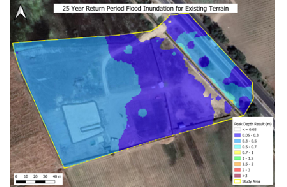
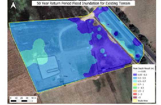
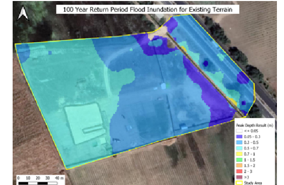
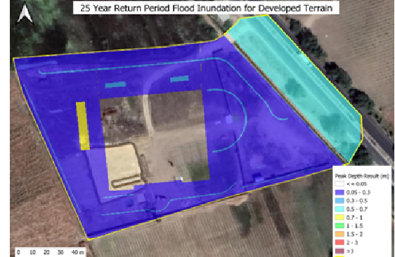
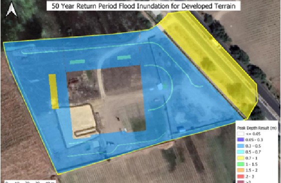
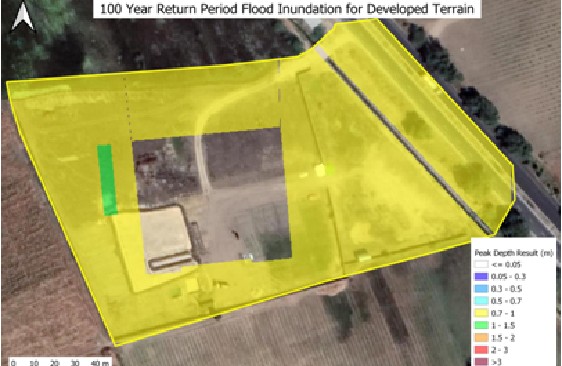
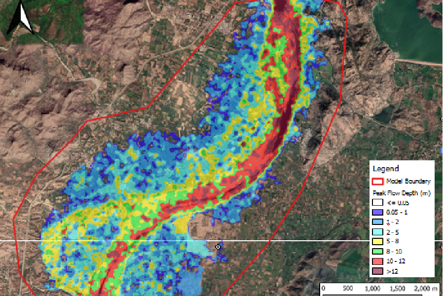
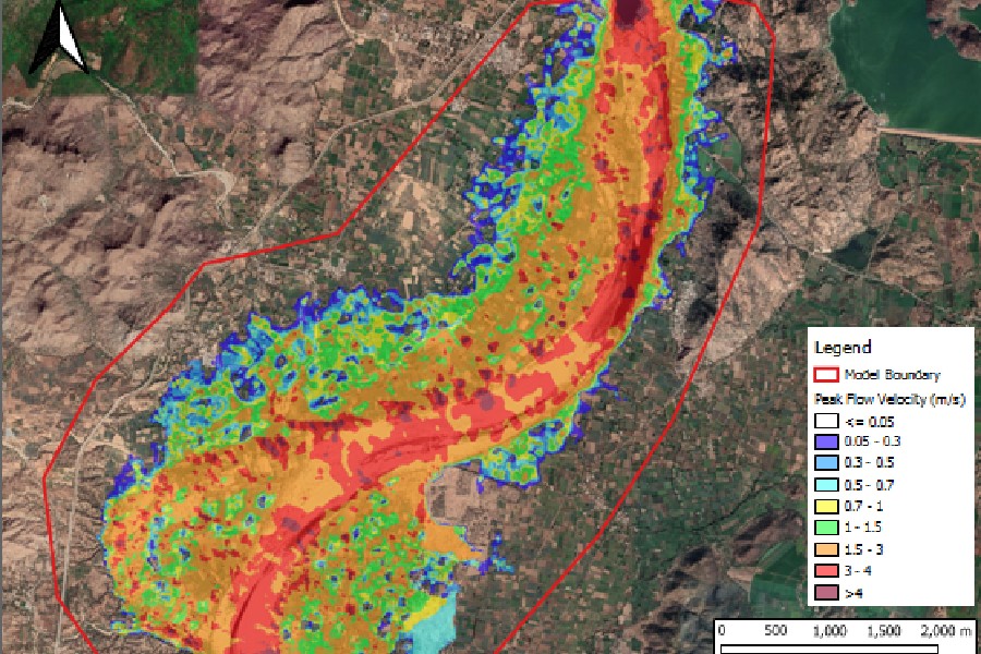
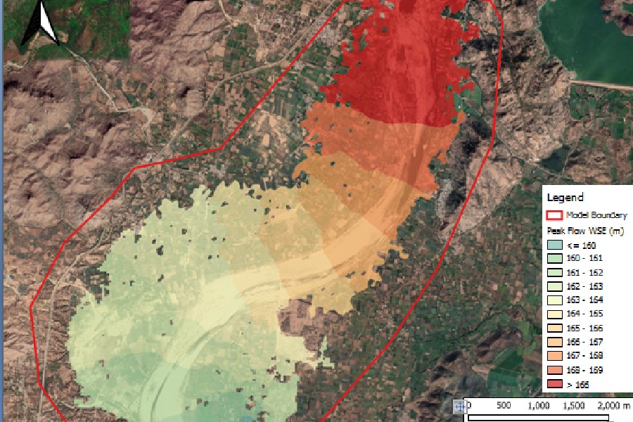
Flood Management is the comprehensive technical investigation of the flood behavior of a catchment, river, or creek. The aims of a flood study will define existing flood behavior, including levels and extents. That will help in identifying flooding areas in the catchment. Flood studies will help to improve our planning and management of the catchment, such as setting flood levels for development control and improving flood emergency responses. 
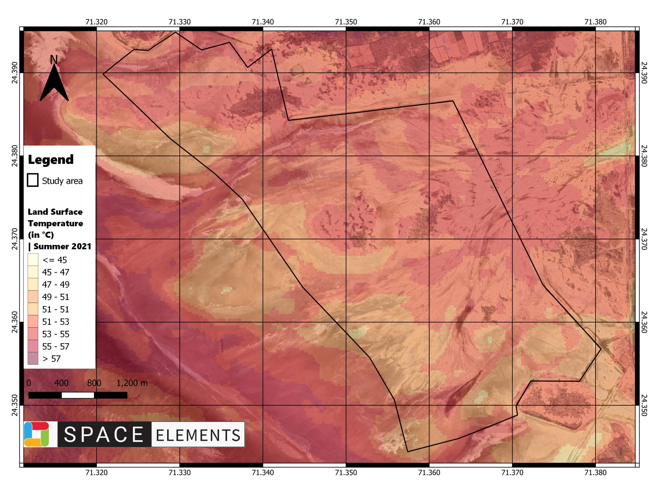
High flood levels and maximum water depth will be used to define the safe development level of the facility for smooth business activities.
25 YEAR RP-PRE-DEVELOPMENT FLOOD STUDY
25 YEAR RP-PRE-DEVELOPMENT
FLOOD STUDY
50 YEAR RP-PRE-DEVELOPMENT FLOOD STUDY
50 YEAR RP-PRE-DEVELOPMENT
FLOOD STUDY
100 YEAR RP-PRE-DEVELOPMENT FLOOD STUDY
100 YEAR RP-PRE-DEVELOPMENT
FLOOD STUDY
25 YEAR RP-POST-DEVELOPMENT FLOOD STUDY
25 YEAR RP-POST-DEVELOPMENT
FLOOD STUDY
50 YEAR RP-POST-DEVELOPMENT FLOOD STUDY
50 YEAR RP-POST-DEVELOPMENT
FLOOD STUDY
100 YEAR RP-POST-DEVELOPMENT FLOOD STUDY
100 YEAR RP-POST-DEVELOPMENT
FLOOD STUDY
DAM DISCHARGE - PEAK FLOW DEPTH
DAM DISCHARGE - PEAK FLOW VELOCITY
DAM DISCHARGE - WATER SURFACE ELEVATION
Need Help?